 |
|
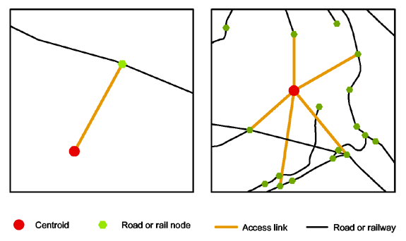
RRG GIS DatabaseAccess links and centroids in the road and railway networksThe access links are functional links used for transport modelling to connect NUTS-2 region centroids to the network (see figure below). Centroids represent the centres of transport analysis zones (TAZ) and are used as origins and destinations. Each centroid is connected to the real-world network via one (left) or several access links (right). The latter aspect is particularly important for the rail network, to connect centroids to all the four directions. The geographical position of centroids is the same in both the road and rail networks. In contrast to the road and railway networks, the waterway network does not contain centroids and access links, but contains virtual port access links.
The centroids of the road and rail networks represent the centroids of the 1995 version of the NUTS-2 regions. Upon request, it would be possible to replace these centroids by the actual NUTS-2 centroids, or by centroids of another NUTS level (for example, NUTS-3 level centroids). More information on the NUTS regions can be found here.
RRG GIS Database contents:General informationTransport networks Region boundaries, admninistrative boundaries Geography Interaction data and regional data Informationen zur RRG GIS Datenbasis sind nur auf Englisch verfügbar. |
|||||||||
|
|||||||||